
China’s Xiang Yang Hong 22 Survey Shows Taiwan’s Undersea War Problem
 Marcus Chen
China’s Xiang Yang Hong 22 Survey Shows Taiwan’s Undersea War Problem
Xiang Yang Hong 22 spent more than a week working around Taiwan’s east and south before Taiwan’s Coast Guard Administration forced it away from restricted waters off Suao early Friday morning. That is the part worth watching. Not the radio warning. Not the legal argument over exclusive economic zones. The useful military question is why a 3,000-ton Chinese oceanographic vessel was operating between Taiwan, Yonaguni, Miyako, Orchid Island, and the Philippine Sea at all.
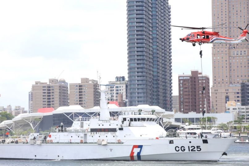
According to the Taipei Times and CNA, Taiwan first tracked the Chinese research ship 41 nautical miles east of Hualien at 8 p.m. Thursday. After warnings, the vessel moved north at about 15 knots, entered restricted waters off Yilan County’s Suao at 11:35 p.m., and was shadowed by the Lanyu patrol vessel and PP-10077. Taiwan says its cutters flanked the ship and used maneuvering to generate waves that disrupted its operations. By 4:20 a.m. Friday, Xiang Yang Hong 22 had left the restricted area and continued north.
The survey line matters more than the protest note
Beijing’s explanation was deliberately bland. Xinhua said the vessel was conducting a maritime ecological survey in waters east of Taiwan. South China Morning Post reported that the survey ran from Tuesday to Thursday under China’s Ministry of Natural Resources East China Sea Bureau, with Beijing describing it as work to understand ecological conditions in what it calls Chinese jurisdictional waters. Taipei’s Ocean Affairs Council rejected that claim, saying China has no jurisdiction over Taiwan’s surrounding waters and is using government and research ships to manufacture a law-enforcement presence.
Both descriptions can be true in a narrow sense. A research vessel can collect ecological data. It can also collect bathymetry, salinity, temperature, current, and acoustic information that make submarines easier to operate and easier to hunt. Anyone who has served at sea knows the chart is only the beginning. In undersea warfare, water itself is terrain. The same sea lane can be transparent or opaque depending on thermal layers, bottom contour, ambient noise, and current.
That is why the east coast of Taiwan is not a side issue. The water drops quickly into the Philippine Sea. For U.S. and Japanese planners, that deep water is the back door into a Taiwan contingency. For China, it is the breakout space beyond the First Island Chain. A survey line east of Taiwan is not just a sovereignty message. It is preparation for the part of the war Beijing cannot solve with missiles alone.
China is mapping the exit routes
The Reuters investigation published by Defense News in March put the broader pattern in hard numbers. Reuters tracked 42 Chinese research vessels over more than five years and found a wide undersea mapping and monitoring effort across the Pacific, Indian, and Arctic oceans. At least eight vessels had conducted seabed mapping, while another 10 carried mapping equipment. The reporting found work near Taiwan and Guam, around the Philippines, near Hawaii, and along approaches to the Malacca Strait.
The operational logic is simple. Submarines need bottom data to avoid hazards, choose routes, and exploit concealment. Anti-submarine forces need water-column data because sonar performance changes with temperature, salinity, currents, and the shape of the seabed. Rear Adm. Mike Brookes of the U.S. Office of Naval Intelligence told a congressional commission this year that China’s expanded surveying enables submarine navigation, concealment, and the placement of seabed sensors or weapons.
Taiwan’s June incident should be read against that campaign. Xiang Yang Hong 22 reportedly left Zhoushan, passed 52 nautical miles east of Japan’s Miyako Island, worked as far as 448 nautical miles east-southeast of Orchid Island, then returned north into the corridor between Yonaguni and Taiwan’s eastern EEZ. Miyako is one of the natural gaps through the First Island Chain. Yonaguni sits roughly 68 miles from Taiwan. Orchid Island watches the southern approach into the Bashi Channel system. These are the routes through which Chinese submarines would try to reach the Philippine Sea and through which U.S. submarines would try to enter a fight.
Taiwan’s visible defense is not enough
Taiwan has spent June demonstrating visible kill chains. USNI News reported that Taiwanese forces fired M142 HIMARS from the west coast on June 10, with launchers relocating within three minutes after firing. Thirty-two rockets were fired and four failed to launch, a useful reminder that combat systems are not slogans. Taiwan also tested Altius-600 loitering munitions against maritime targets, using flatbed launchers and rehearsing detection, identification, and strike against ships closing toward landing areas.
Those systems matter. HIMARS can threaten ports, assembly areas, and beachheads. Altius-600M loitering munitions, with a small warhead and roughly 99-mile range, help fill the gap between long-range anti-ship missiles and short-range artillery. For an island trying to break up amphibious movement, mobile launchers and cheap unmanned systems are the right direction.
But the east-side undersea problem is different. You cannot HIMARS a survey pattern after it has already built a database. You cannot deter seabed sensors with a press release. Once China improves its acoustic picture east of Taiwan, the military value lasts for years. Every additional track line improves route planning, sensor placement, and confidence for submarine commanders.
The real contest is maritime persistence
Taiwan’s coast guard response was competent but small. One patrol vessel and one boat can shadow and harass a research ship in restricted waters. They cannot cover the whole eastern EEZ, Pratas, Itu Aba, Kinmen, and the waters between Taiwan and Japan at the same time. Taipei says it has adopted one-on-one tracking of incoming Chinese vessels. That is sensible, but it is manpower-intensive and puts the weaker side into a matching game.
China wants exactly that kind of arithmetic. It can send coast guard cutters, research ships, maritime militia, and naval units in overlapping layers. Taiwan must decide when to respond, how close to maneuver, and how much risk to impose on crews. If Japan and the Philippines are also drawn into the same EEZ argument, Beijing can stretch three governments across one maritime problem.
The United States should care because this is not just Taiwan’s law-enforcement dispute. If China can normalize research-vessel operations east of Taiwan, it improves the battlespace where U.S. submarines are supposed to retain an advantage. Washington’s Taiwan policy often focuses on missiles, drones, and arms-delivery timelines. Those are necessary. They are also incomplete without maritime domain awareness, acoustic intelligence sharing, and persistent patrol capacity east of the island.
Xiang Yang Hong 22 leaving Suao’s restricted waters is not the end of the story. It is one data point in a Chinese effort to make the waters east of Taiwan less friendly to U.S. and allied submarines, and more usable for the People’s Liberation Army Navy. Taiwan can drive away the ship. The harder task is preventing the map from being built in the first place.
Xiang Yang Hong 22, a Chinese oceanographic vessel, conducted a maritime ecological survey and undersea mapping near Taiwan from Tuesday to Friday. The vessel was tracked by Taiwan's Coast Guard, which attempted to disrupt its operations in restricted waters. This activity is part of China's broader strategy to enhance its undersea warfare capabilities in the region, impacting U.S. and allied submarine operations.
- Xiang Yang Hong 22 operated near Taiwan for over a week before being forced away by Taiwan's Coast Guard.
- The vessel was conducting a maritime ecological survey, which also has military applications for undersea warfare.
- Taiwan's Coast Guard tracked the vessel and attempted to disrupt its operations.
- China's survey activities are part of a broader undersea mapping effort across various oceans.
- The east coast of Taiwan is strategically significant for both Chinese and U.S. military operations.