
Mali locks down 35 forest areas in 2026 — Bamako tries to cut the bases of JNIM
 Marie Dubois
Mali locks down 35 forest areas in 2026 — Bamako attempts to cut off JNIM's bases
On June 3, in Bamako, an inter-ministerial decree placed classified forests, reserves, and protected areas under enhanced military surveillance. This is not an ordinary administrative measure. It is an attempt to reclaim the invisible terrain of the Malian war: the paths, the vegetation cover, the bivouac areas, and the supply corridors that political maps poorly depict.
According to the African Press Agency, 35 "military interest zones" have been identified, mainly in the center, south, and west of Mali. The names mentioned — Faya, Soussan, Kékoro, Sorodian, Kangaba, Kéniébaoulé, Bossofala, Kobri, as well as the Boucle du Baoulé National Park — outline a precise geography. These are not the vast sands of the north. They are the wooded and semi-wooded areas close to useful roads, agricultural zones, trade flows, and the outskirts of Bamako.
This is new in scale. But the idea itself is not: in a war of mobility, whoever controls the resting areas often controls the rhythm of the opponent.
A decree to militarize the rear
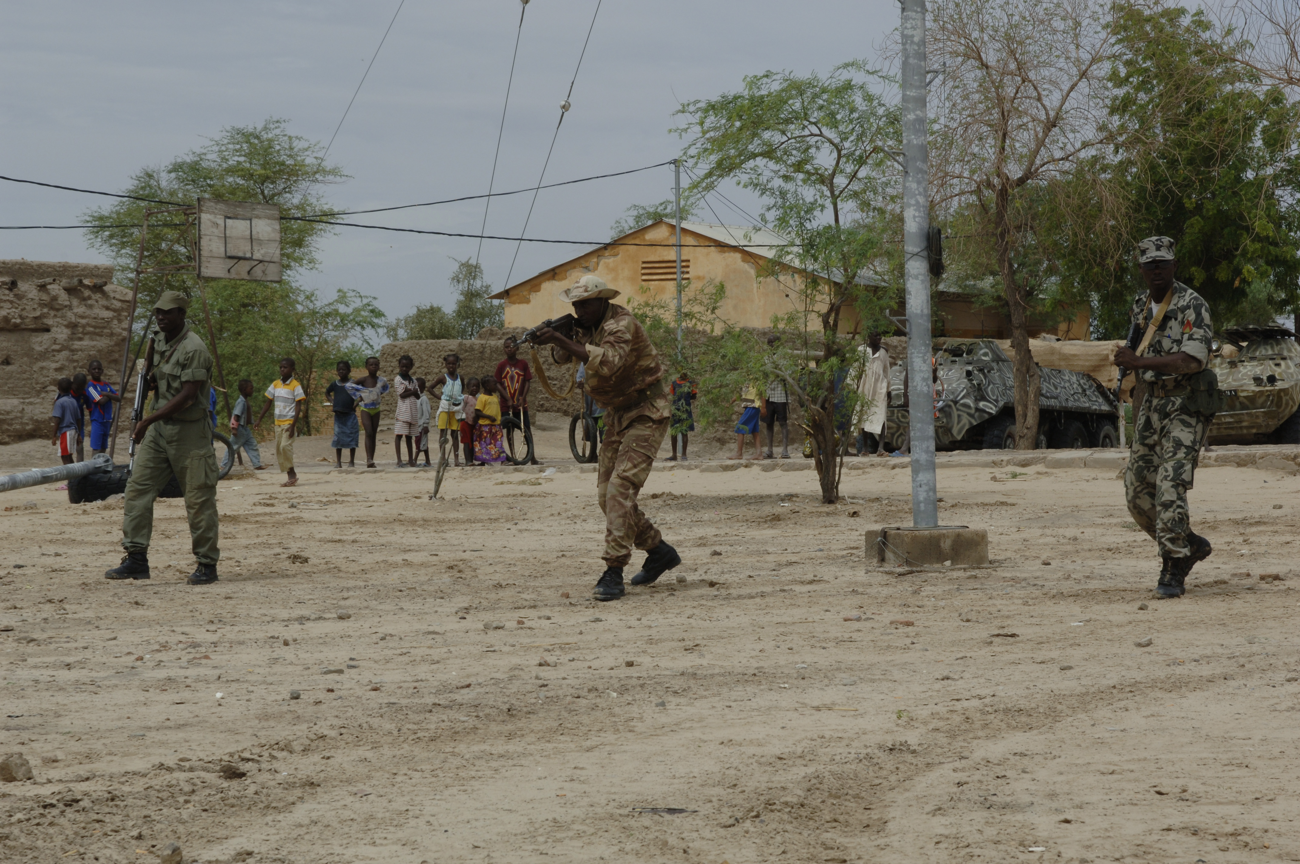
The text signed in Bamako replaces a previous arrangement adopted at the end of December 2023 under Operation Maliko. It is now part of Operation Dougoukoloko, with several ministries involved: Defense, Security, Justice, Territorial Administration, Transport, and Environment. On paper, this gives the army a broader capacity to grant or deny access to certain areas, conduct operations against identified targets, and allow, under military instruction, security forces, customs, and forestry agents to enter.
On the ground, this means something else: the post chief, the sector commander, or the local intelligence officer becomes the arbiter of an area where shepherds, wood collectors, farmers, hunters, transporters, and sometimes displaced families also pass through. This is where the difficulty begins.
I have seen, in the Sahel, gridlock arrangements fail not because the map was wrong, but because local life did not fit into the boxes. A classified forest can be a jihadist refuge on Monday, a grazing area on Tuesday, and a civilian escape corridor on Wednesday. The enemy knows this. It plays precisely on this ambiguity.
Why these forests matter more than their names suggest
The choice of areas is not innocent. Faya, Kangaba, or the Boucle du Baoulé are not just environmental spaces. They are located in a strategic depth that connects the approaches to Bamako, the roads to Kayes, Sikasso, and Ségou, and the corridors that allow armed groups to disappear after an action. A motorized column can hold a road for a few hours. A light group can live around that road for weeks.
The Support Group for Islam and Muslims (JNIM, affiliated with Al-Qaeda) has long understood that hitting a barracks is only part of the fight. Sustained pressure comes from controlling the axes. The Institute for Security Studies reminded on June 4 that JNIM's blocking tactics now threaten West Africa's trade corridors, particularly those connecting coastal ports to Sahelian capitals. The figure cited for the Dakar-Bamako corridor is telling: about 1.47 million tons of goods transported by the end of 2025, on an axis now exposed to attacks in the Sikasso region.
If Bamako militarizes forests, it is therefore not only to search for fighters. It is to prevent these spaces from serving as garages, depots, taxation zones, fuel caches, and regrouping points before an attack on the roads.
The lesson of April 25
The decision comes a little over a month after the coordinated attacks on April 25 against several Malian points, including Bamako, Kati, Gao, Sévaré, Mopti, and Kidal. These actions, claimed or attributed in some cases to JNIM and the Azawad Liberation Front (FLA), demonstrated a coordination rarely achieved since the beginning of the Malian crisis. They especially broke a narrative: that of a state that had regained the initiative thanks to military sovereignty and Russian partnership.
The reality is less comfortable. The Malian armed forces and Africa Corps still have heavy means, air support, and superior firepower. But the adversary increasingly imposes its locations and timings. Military Africa reported in early June that Russia's Africa Corps is now deploying FPV drones in Mali, in a sky already contested by drones from the FLA, JNIM, and other armed groups. This means that even tactical reconnaissance, once an advantage for the state camp, is becoming contested.
In this context, creating military forest zones resembles a ground response to a war that has become more aerial and fluid. It is necessary to prevent the adversary from retreating, but also to prevent its drone operators, scouts, and transporters from working from spaces that the state no longer monitors.
The civil risk is operational, not just humanitarian
The Boucle du Baoulé National Park is part of a biosphere reserve recognized by UNESCO since 1982 and covers nearly 2.5 million hectares, with natural reserves, ecological corridors, and over 300 documented archaeological sites. But for the locals, the immediate issue is simpler: can they still graze animals, collect wood, cross a path, sell at the nearby market?
If military authorization becomes arbitrary or slow, Bamako will create daily frictions. These frictions are a resource for JNIM. The group rarely recruits solely by pure ideology; it exploits humiliations, abusive taxes, land disputes, disappearances, and poorly conducted operations. A poorly explained no-go zone can produce intelligence for the army. It can also produce silence in the villages.
The decisive question is therefore not whether the army has the right to enter these forests. Of course, it does, in a country attacked on multiple fronts. The question is whether it can stay there without cutting off the populations from their means of livelihood. A military presence that does not protect civilians quickly becomes a transient presence. Armed groups simply wait for it to leave.
What Bamako must monitor now
Three indicators will tell if this measure changes anything. The first will be the frequency of attacks against the Bamako-Kayes, Bamako-Sikasso, and secondary roads to the center. If ambushes decrease without shifting to other corridors, the pressure will have had a real effect.
The second will be the quality of local intelligence. Mass arrests prove nothing. Discovered caches, seized motorcycles, removed fuel stocks, and interrupted logistical routes would be more significant.
The third will be the reaction of the communities. If restrictions close markets, prevent herds from passing, or multiply informal payments at checkpoints, the arrangement will cost more than it brings in. In the Sahel, one does not secure a forest against the people who know it. One secures it with them, or one loses it.
The militarization of Malian forests may hinder JNIM, but only if it remains mobile, informed, and politically sober. A military interest zone is not a Maginot line. It is a bet on presence.
The next test will not be in Bamako, but on a less visible path: a fuel truck that passes or does not pass, a patrol that finds a cache before the ambush, a village chief who warns or remains silent. This is where this war is decided, far from press releases.
Main sources
Mali has militarized 35 forest areas as of June 3, 2026, to counter the operations of the JNIM group. This initiative aims to control supply routes and disrupt JNIM's activities in strategic locations. The move follows recent coordinated attacks by JNIM on various points in Mali, indicating a shift in military strategy to enhance operational control in the region.
- Mali has locked down 35 military interest zones in forests.
- The operation aims to disrupt JNIM's supply routes and hideouts.
- Military surveillance has been increased in these areas.
- The decision follows coordinated attacks by JNIM on multiple locations in Mali.
- The militarization of forests is part of a broader strategy to control mobility in the region.