
China's 2026 Taiwan Seabed Mapping Makes Five PLAN Ships an Undersea Warning
 Marcus Chen
China's 2026 Taiwan Seabed Mapping Makes Five PLAN Ships an Undersea Warning
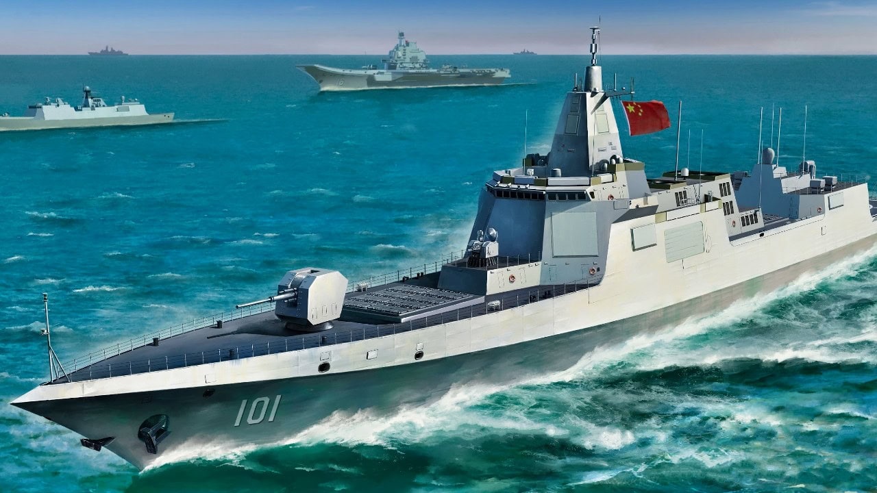
Five People's Liberation Army Navy ships and zero PLA aircraft were the June 15 count around Taiwan. On paper, that looks quieter than the usual air-defense identification zone surge. It is not. Taiwan's Ministry of National Defense said the five PLAN ships were operating around the island between 6 a.m. June 14 and 6 a.m. June 15, while no PLA aircraft were detected in the same window. The flight map was blank. The maritime problem was not.
The important movement is east, not west. A Taiwan fight is usually described through the Strait, but Taiwan's eastern approaches are where submarines, replenishment routes, evacuation corridors, and U.S. naval access all become decisive. China's recent coast guard, maritime safety, rescue, research, and naval activity on that Pacific side is not a sideshow. It is a slow attempt to make the eastern water space administratively normal and militarily knowable.
China Is Moving the Contest to the Pacific Side
USNI News reported on June 8 that China deployed six cutters and patrol ships east of the Luzon Strait in what Beijing called a maritime law-enforcement operation. Taiwan identified the formation roughly 140 nautical miles east of the island. The composition mattered: two China Coast Guard cutters, three Maritime Safety Administration patrol ships, and one rescue and salvage vessel. That is not a classic invasion package. It is a jurisdiction package.
The message was aimed at more than Taipei. Beijing linked the operation to Japan and the Philippines discussing maritime boundary delimitation in waters east of Taiwan and north of Luzon. If China can treat those waters as a routine Chinese enforcement area, then Tokyo and Manila have a new problem before a crisis even starts. They would be negotiating maritime space under the shadow of Chinese state vessels that have already practiced presence there.
USNI also noted that Taiwan placed the Liaoning carrier strike group about 400 nautical miles east of Luzon, with the USS George Washington carrier strike group operating farther south near Mindanao. That geography is the point. The Philippine Sea is no longer a rear area in Chinese planning. It is becoming part of the contact layer.
The Seabed Is the Target Set
The latest reporting from The Times says Chinese coast guard and research vessels recently conducted a five-day operation east of Taiwan that included ship inspections and seabed mapping. Treat the details cautiously because the operation is partly political theater, but the military logic is straightforward. A submarine does not fight in generic blue water. It fights in temperature layers, salinity gradients, bottom contours, acoustic shadows, and cable routes.
Anyone who has served at sea understands the difference between a chart and an environment. Bathymetry tells a submarine where it can hide, where it can bottom, where it can avoid predictable search lanes, and where an adversary's sonar picture gets messy. Water-column data tells an anti-submarine force when sound bends, fades, or carries. In deep water east of Taiwan, that information is worth more than another press release about sovereignty.
Reuters-based reporting earlier this year traced a much larger Chinese ocean-mapping effort across the Pacific, Indian, and Arctic oceans, involving 42 research vessels in the examined dataset. At least eight had conducted seabed mapping, while another 10 carried mapping equipment. That is the industrial-scale version of what the Taiwan east-side operations suggest locally. It is not one ship taking samples. It is a state system building an operating picture.
Five Ships Can Still Change the Fight
The June 15 MND report listed five PLAN ships and no PLA aircraft. That aircraft number is easy to overread. Air activity is visible, dramatic, and politically useful. Ships are slower and less cinematic, but they stay. A destroyer, frigate, survey ship, coast guard cutter, or maritime safety vessel can sit on a lane, collect signals, confirm reaction times, and normalize its presence in a way aircraft cannot.
For Taiwan, the eastern side is supposed to be the relief valve. Ports such as Hualien and Suao matter because they face the deep Pacific rather than the narrow Strait. In a blockade or invasion scenario, the eastern approaches are where Taiwan would try to preserve naval movement, receive outside support, and keep some air and missile assets alive after western bases came under pressure. Chinese presence there complicates that assumption.
The operational math is harsh. Taiwan is about 100 nautical miles from the mainland across the Strait, but its eastern sea lanes stretch into a much larger battlespace that touches Japan's southern islands and the northern Philippines. If Chinese ships can operate 140 nautical miles east of Taiwan as an enforcement matter in peacetime, then a wartime U.S. or Japanese planner has to assume Chinese sensors, surface ships, unmanned systems, and submarines may already understand the water space.
Beijing Is Saying the Quiet Part Out Loud
The Guardian reported on June 12 that China's Ministry of State Security accused foreign actors of using sensor-equipped marine animals, buoys, and wave gliders to gather oceanographic data near Chinese waters. Strip away the theatrics and the accusation reveals how Beijing thinks. Temperature, salinity, currents, acoustic signatures, and vessel activity are not academic data sets. They are military inputs.
China's public warning about underwater devices also fits its own behavior. If Beijing believes foreign seabed sensors and wave gliders can threaten Chinese submarines, then Chinese mapping and sensor placement near Taiwan should be read the same way by U.S., Japanese, Philippine, and Taiwanese planners. The issue is not whether a device has a military label. The issue is whether the collected data changes who can move undetected below the surface.
This is where Washington's usual Taiwan debate is too narrow. More anti-ship missiles matter. More air-defense interceptors matter. But a Taiwan contingency would also be an anti-submarine warfare contest across the Philippine Sea. U.S. attack submarines would be among the most valuable assets available to break a blockade, hunt Chinese surface combatants, and threaten invasion shipping. If China reduces the U.S. undersea information advantage east of Taiwan, it does not need to match the U.S. submarine force boat for boat.
The Warning Is Below the Surface
China's June activity does not mean a blockade is imminent. It means Beijing is doing the dull preparatory work that makes blockade options more credible later. The five PLAN ships counted by Taiwan on June 15 are one visible piece. The six-vessel law-enforcement package east of Taiwan is another. The seabed mapping is the part that matters most because it is hardest to reverse.
The United States and its allies still talk about the first island chain as if geography does the work for them. Geography only helps if you know it better than the other side and can keep using it under pressure. East of Taiwan, China is trying to remove that advantage one patrol, one survey line, and one claimed enforcement operation at a time.
The flight map was blank on June 15. That is exactly why the ship count mattered.
Five People's Liberation Army Navy ships operated around Taiwan from June 14 to 15, 2023, while no PLA aircraft were detected. The ships conducted seabed mapping and maritime law enforcement east of Taiwan, indicating a strategic shift in China's military operations. This presence complicates Taiwan's defense and highlights China's efforts to normalize its military operations in the region.
- Five PLAN ships were reported operating around Taiwan without any PLA aircraft present.
- China is conducting seabed mapping and maritime operations east of Taiwan.
- The presence of PLAN ships complicates Taiwan's defense strategy in the eastern approaches.