
Coast Guard 08 Completes Survey 1,025 Nautical Miles East of Taiwan, Filling in the Deep Water Area of the PLA's Anti-Submarine Puzzle
 Li Minghui
Haixun 08 Completes 1025 Nautical Mile Survey East of Taiwan, Filling in the Deep Water Area for PLA Anti-Submarine Puzzle
A detail disclosed by the South China Morning Post on June 11 is more interesting than the headline itself: Haixun 08 traveled 1025 nautical miles in the waters east of Taiwan over five days. This number sounds like a routine maritime patrol, but if viewed on a submarine operational map, its significance changes. The waters off the eastern coast of Taiwan are not shallow; they are part of the deep water area of the Western Pacific, which is the side where U.S. and Japanese submarines, anti-submarine patrol aircraft, and underwater listening systems can most easily intervene in the Taiwan Strait.
According to a report by the Central Television (CCTV) account Yuyuantan Tian cited by the South China Morning Post, this is the first time that mainland maritime authorities have conducted hydrological surveys east of Taiwan, aiming to complete the previously incomplete seabed mapping data for that area. The operation was coordinated by multiple departments, including the Coast Guard, local maritime bureaus, the East China Sea Navigation Guarantee Center, and the East China Sea Rescue Bureau. I believe this multi-departmental packaging is crucial: it appears to be maritime management on the surface, but in essence, it is accumulating foundational maps for the Navy's future underwater situational awareness.
Why Seabed Data is More Important than the Number of Warships
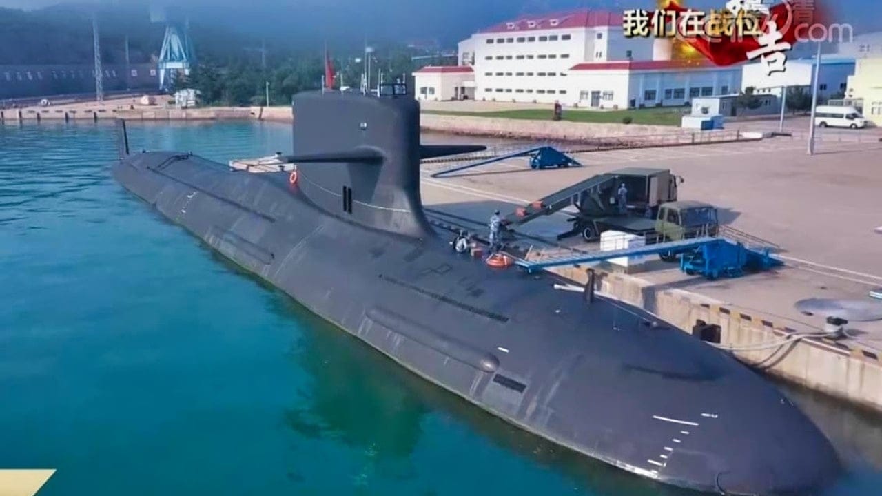
Anti-submarine warfare is not just about turning up the sonar. The seabed topography, thermocline, salinity, ocean currents, and sediments all affect sound wave propagation. In simple terms, the same sonar system may perform differently in different maritime areas. The western side of Taiwan has a shallow, narrow strait with high noise levels; the eastern side connects to the Philippine Sea, where the water depth drops sharply, making it more favorable for the covert navigation of nuclear submarines. Whoever has more detailed marine environmental data can more easily determine where submarines might be hiding and plan safer routes for their own submarines.
This is precisely what makes Haixun 08 noteworthy. It is not a fishing enforcement vessel or an ordinary law enforcement boat, but rather a more advanced large survey ship from China. The South China Morning Post mentioned that this survey covered 1025 nautical miles, focusing on the complex waters east of Taiwan. Public information does not specify the measurement accuracy, sensor models, or operational route details, so it cannot be directly equated with military mapping. However, from a military engineering perspective, hydrological databases have typical dual-use attributes; the more fundamental the data, the more easily it can be repeatedly accessed by multiple subsequent systems.
The Immediate Pressure on Taiwan is Not in the Air
The Taiwan defense department reported on June 20 that between June 19 and 20 at 6 a.m., it detected five sorties of PLA aircraft, nine PLA vessels, and five government ships operating around the Taiwan Strait, with one aircraft entering the southwest air defense identification zone. The report from June 19 indicated that all four sorties crossed the median line of the strait and entered the northern air defense identification zone. Looking solely at the number of aerial sorties, these two days are not particularly high; what truly needs to be viewed in conjunction is that warships, government vessels, and survey ships are forming a low-intensity but continuous maritime presence.
This is also an aspect that many reports tend to overlook. Aircraft crossing the line creates a visual impact, and warships circling Taiwan easily make the news; hydrological surveys, however, resemble slow work. Yet in modern naval warfare, slow work often determines the upper limits during wartime. If China wants its Type 093B attack submarines, conventional submarines, or future unmanned underwater platforms to operate east of Taiwan, it must first understand the acoustic and topographical details of that underwater space. Without such foundational maps, the so-called offshore anti-submarine operations and submarine ambushes can only remain at the conceptual level.
Viewing Together with Taiwan's HIMARS Test Launch
In the same week, Axios reported that Taiwan conducted its first test launch of U.S.-made HIMARS rocket artillery towards the Taiwan Strait from its west coast, practicing rapid relocation after mobile launches. This action targets landing craft and beachhead assembly objectives, with a very direct logic. However, it strengthens the defense of Taiwan's west coast, while the mainland's survey points to the deep water area east of Taiwan. One focuses on intercepting landing routes with firepower, while the other compresses the space for external submarines to enter the Taiwan Strait battlefield, together forming two different layers of combat in the Taiwan Strait.
From a supply chain perspective, seabed mapping has another less obvious advantage: it does not require large-scale deployment like aircraft carriers or stealth fighters. Once the measurement data enters the database, it can serve the Navy, Coast Guard, maritime authorities, research, and unmanned systems. CSIS previously analyzed China's Zhuhai Yun and other high-tech research vessels, noting that China's large civilian research vessel fleet can serve strategic objectives, with some platforms equipped with unmanned surface, aerial, and underwater systems, blurring the boundaries. Haixun 08's recent operation falls precisely within this blurred boundary.
Cannot Overstate but Also Cannot Underestimate
I do not believe that a five-day survey can change the underwater power balance in the Taiwan Strait. The marine environment is dynamic; seasons, typhoons, and branches of the Kuroshio Current can all affect data validity; what is truly valuable is long-term, repeated, grid-based collection. Public data also cannot prove that the data collected by Haixun 08 will be directly handed over to the Navy. However, if we see more survey ships, Coast Guard vessels, and rescue ships conducting similar routes in the waters east of Taiwan in the future, it will not be an accidental event, but rather a normalization of database construction.
The military competition in the Taiwan Strait has often been simplified to aerial sorties, missile ranges, and the number of aircraft carriers. Yet what truly determines battlefield transparency is often these less glamorous foundational projects. The 1025 nautical miles that Haixun 08 has covered may not attract attention like the J-20 or Fujian aircraft carrier, but it is providing the PLA with an underwater map. The next question worth asking is: will the mainland expand this mapping from east of Taiwan to the critical anti-submarine corridor between the Bashi Channel and the Miyako Strait?
Main Sources
- South China Morning Post, June 11, 2026, What’s behind Beijing’s seabed mapping east of Taiwan?
- Taiwan Defense Department, June 19 and June 20, 2026, Dynamic Report on Air and Sea Activities around the Taiwan Strait
- Axios, June 17, 2026, Taiwan tests Lockheed launchers in China direction
- CSIS, February 26, 2024, China’s New High-Tech Research Ship Probes the Waters around Taiwan
Chinese Coast Guard's Haixun 08 completed a 1025 nautical mile hydrographic survey east of Taiwan from June 11 to 20, 2026. This operation, involving multiple agencies, aims to gather critical underwater data for military applications. Concurrently, PLA Air Force and Navy activities were reported in the region, indicating a coordinated effort to enhance military presence and intelligence capabilities.
- Chinese Coast Guard's hydrographic survey vessel Haixun 08 completed a 1025 nautical mile survey east of Taiwan.
- The survey aims to gather underwater topographic data for military purposes.
- PLA Air Force and Navy were active in the region during the survey period.
- Taiwan's defense reported multiple incursions by Chinese military aircraft and vessels.
- The survey is part of a broader strategy to enhance underwater situational awareness.