
Coast Guard 08 Conducts First Survey of Eastern Waters Around Taiwan, PLA Anti-Submarine Log Completes 1,025 Nautical Miles of Underwater Data
 Li Minghui
Coast Guard 08 Conducts First Survey of Eastern Waters Around Taiwan, PLA Completes 1025 Nautical Miles of Underwater Data Collection
On the evening of June 10, the Ministry of Transport announced the conclusion of a special maritime traffic law enforcement and survey operation in the eastern waters around Taiwan. On the surface, this news appears to be about maritime law enforcement, but what caught my attention were two numbers: a total voyage of 1030 nautical miles and a survey distance of 1025 nautical miles. The two sets of numbers are nearly identical, indicating that this was not an ordinary circumnavigation of the island, but rather a task that combined law enforcement routes, buoy inspections, vessel checks, and hydrographic surveys into a single mission.
According to China Daily and Xinhua News Agency, this operation took place from June 6 to 10, involving units such as the Fujian Maritime Safety Administration, Guangdong Maritime Safety Administration, East China Sea Navigation Guarantee Center, and East China Sea Rescue Bureau; public reports mentioned that Coast Guard 09, Coast Guard 06, Coast Guard 08, and East China Sea Rescue 113 participated, inspecting 198 passing vessels and correcting 3 violations. Global Times further clarified that Coast Guard 08 was responsible for the survey mission in the eastern waters around Taiwan.
Why the Eastern Waters Around Taiwan?
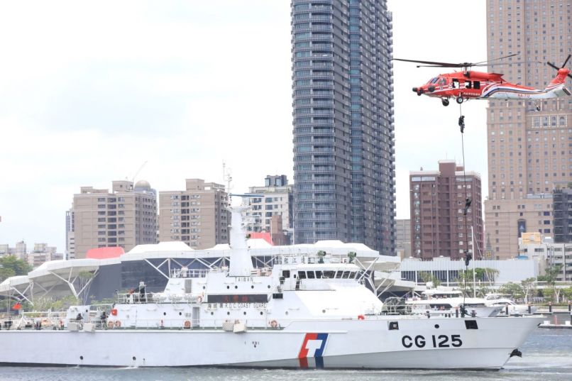
Discussions about military affairs in the Taiwan Strait often focus on the landing sites on the western coast, but the eastern waters around Taiwan are actually more challenging to manage. This area is not a shallow beachhead, but rather a deep-water flank facing the Philippine Sea. The continental shelf drops off rapidly on the eastern side of Taiwan, and factors such as water depth, seabed slope, thermocline, ocean currents, and the distribution of underwater cables all affect submarine navigation, anti-submarine searches, and the deployment of underwater sensors. In simple terms, the seabed map is not for press conferences; it is for sonar equations and route planning.
The Times on June 15 interpreted this operation as China's preparation for submarine warfare around Taiwan, stating that Chinese vessels had inspected foreign merchant ships and conducted seabed mapping in Taiwan's eastern economic waters. This assessment may contain exaggerations, but the direction is not unreasonable. If the U.S. and Japan intervene in the Taiwan Strait, the most valuable underwater passages are not in the Taiwan Strait, but in the Bashi Channel, Miyako Strait, and the Philippine Sea side. The more detailed the data from the eastern waters, the less uncertainty the PLA Navy has regarding anti-submarine operations, submarine stealth ingress and egress, and underwater early warning.
The Military Implications of Maritime Vessels
What is noteworthy this time is not the presence of warships, but rather the absence of warships being prominently displayed. Coast Guard 09 is a 10,000-ton maritime patrol vessel, Coast Guard 06 has long operated in the Taiwan Strait, and Coast Guard 08 is a specialized survey vessel. The logic of this combination is clear: the maritime system is responsible for the narrative of administrative jurisdiction, the survey vessel is responsible for data collection, and the Coast Guard or Navy does not need to be present every time. This is more complex than simply dispatching warships, as it mixes low-intensity law enforcement, navigation safety, and quasi-military data accumulation.
- A voyage of 1030 nautical miles indicates that the mission covered a long arc in the eastern waters around Taiwan, rather than a single-point demonstration.
- A survey distance of 1025 nautical miles shows that the navigation itself was part of the measurement process, with water depth and channel data being updated in real-time.
- Inspecting 198 vessels grounds the "existence of law enforcement" in specific interactions with merchant ships, forming repeatable administrative actions.
Of course, Taiwan does not accept this interpretation. Taipei Times reported that the Taiwan Coast Guard stated that the mainland has no sovereign rights in the eastern waters around Taiwan and dispatched patrol vessels to monitor the situation. USNI News noted that this group of vessels was once spotted about 140 nautical miles east of Taiwan, emphasizing that their position was on the Pacific side of the First Island Chain, rather than in the more commonly seen Taiwan Strait or South China Sea.
The Real Value of PLA Modernization
I believe that the military value of this operation cannot simply be described as a "blockade rehearsal." A blockade requires the combined effects of naval and air firepower, legal packaging, insurance market pressure, and port control; a single maritime survey is far from sufficient. However, it does fill a frequently overlooked gap in the PLA's modernization: underwater battlefield environmental data. Advanced submarines, fixed-wing anti-submarine aircraft, and unmanned underwater vehicles are all well and good, but if the baseline map is rough, it is like equipping a sports car with a foggy windshield.
There is also a shortcoming here. Public reports did not specify the accuracy of the depth measurement equipment used by Coast Guard 08, whether the data was entered into military databases in real-time, or the data-sharing mechanisms between the maritime, coast guard, and navy sectors. The Chinese military-industrial system has made rapid progress in platform manufacturing, but there is still insufficient public evidence regarding cross-departmental data standards, continuous updates, and rapid wartime mobilization. The 1025 nautical mile survey is a signal, but it does not mean that a complete underwater combat system has been fully established.
What is truly worth continuing to observe is not whether Beijing will send Coast Guard vessels to the eastern waters around Taiwan again, but whether these seemingly civilian survey routes will become normalized, grid-like, and increasingly aligned in timing with coast guard patrols, anti-submarine aircraft training, and navy submarine activities. If we see Coast Guard 08, research vessels, and coast guard fleets repeatedly appearing in the same waters over the next few months, that would indicate that this "eastern seabed map" is transitioning from a political maneuver into a set of operational infrastructure.
The China Coast Guard conducted a maritime enforcement and survey operation along the East Coast of Taiwan from June 6-10, 2023, covering 1030 nautical miles. This operation involved inspecting 198 vessels and is interpreted as preparation for potential submarine warfare, gathering critical underwater data. The operation's focus on the East Coast highlights its strategic military significance.
- China Coast Guard conducted a survey operation in the East Coast of Taiwan from June 6-10, 2023.
- The operation covered a distance of 1030 nautical miles, with 1025 nautical miles specifically for surveying.
- 198 vessels were inspected during the operation, correcting 3 violations.
- The operation is seen as preparation for submarine warfare in the region.
- The survey data is crucial for underwater operations and anti-submarine warfare.