
The WAP Park Becomes a Jihadist Base — 1.29 Million Hectares Challenge Benin, Burkina Faso, and Niger
 Marie Dubois
The WAP Park Becomes a Jihadist Base — 1.29 Million Hectares Challenge Benin, Burkina Faso, and Niger
On July 20, the West African security debate shifted to a less spectacular terrain than an attacked base or a burned convoy: the forest. In the W-Arly-Pendjari complex, straddling Benin, Burkina Faso, and Niger, the Support Group for Islam and Muslims (GSIM/JNIM) is no longer just using the vegetation as a hiding place. It is building an operational depth there.
This detail changes the map. The WAP covers approximately 1,291,210 hectares, including 568,000 in Benin, 235,000 in Burkina Faso, and 220,000 in Niger. On paper, it is an ecological heritage site classified by UNESCO. On the ground, it is a space for crossing, storage, recruitment, and smuggling, with paths that disappear after rain and villages that depend more on local trade than on distant ministries.
A Refuge That Becomes a Maneuvering Area
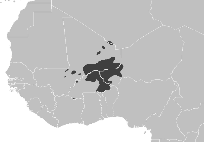
AllAfrica, citing an analysis published on July 20, describes a phenomenon that is now well established: jihadist groups exploit forests to shelter bases, tax natural resources, control trafficking, and forge ties with local populations. The WAP is cited as the largest forest massif in West Africa, but also as one of the points where the administrative border hinders armies more than it hinders insurgents.
Since 2018, according to cited work from the International Crisis Group, katibas linked to JNIM, including Ansarul Islam and Serma, have taken root in this area. They impose zakat, levy on gold mining, control flows of fuel, motorcycles, medicines, and sometimes livestock. This is not just funding. It is low-intensity armed governance.
From experience, a regular force can clear a locality in a few hours if it has reliable intelligence. It cannot hold a border forest of over a million hectares with press releases. It requires scouts, maintained paths, local relays, medical evacuation, fuel, drones that actually fly, and above all, a presence that returns the next day.
Benin Discovers the Depth of the Sahel Front
Benin has long been treated as a coastal state exposed by proxy. This reading is outdated. The northern part of the country, particularly the areas around Pendjari, directly touches the logic of the three-border zone. Attacks originating from Burkina Faso and Niger do not always seek visible conquest. They test routes, punish informants, and prevent security forces from moving normally.
The figure mentioned by AllAfrica is telling: over 120 soldiers are said to have lost their lives near the three-border region between 2021 and 2024, followed by about thirty others in January 2025. Four months later, GSIM reportedly killed around fifty Beninese soldiers in the north. All these tolls require caution, as the states in the region strictly control military information. But the trend is not uncertain.
The problem with the WAP is not that jihadists hide there. The problem is that they can come out, strike, resupply, and return without having to defend a city.
This is an essential tactical difference. An urban base can be monitored. A crossroads can be blocked. A cross-border forest is negotiated with geography, the season, local hunters, traffickers, and neighboring units. When regional cooperation breaks down, as between the states of the Sahel States Alliance (AES) and the Economic Community of West African States (ECOWAS), this forest becomes larger than it appears on the map.
Aerial Response Is Not Enough
The governments of the region have understood the danger. Mali declared on June 3, 2026, thirty-nine forests and protected areas as military interest zones prohibited to the public, as part of Operation Dougoukoloko. Burkina Faso has been implementing security measures for its classified forests since 2022. Niger has designated wooded areas in Torodi as "red zones." Côte d'Ivoire, after the death of a forest ranger on June 20, reaffirmed its intention to protect its classified forests.
These decisions say two things. First, states now see the forest as a full-fledged theater of operations. Second, they do not have a solution of their own. Banning an area may hinder an armed group, but it can also cut civilians off from their fields, hunting, or roads. When the army announces that it "systematically targets" anyone present, it simplifies the tactical problem and complicates the political problem.
Aerial means are useful, of course. Helicopters, drones, and sensors can spot camps, track motorcycles, neutralize a column before it reaches an isolated post. But air power does not replace human intelligence. In a forest, a drone sees a clearing; a villager knows why it is empty that morning.
A Corridor War Towards the Gulf of Guinea
The July UN briefing on West Africa and the Sahel confirms that the threat is quickly targeting the coastal states of the Gulf of Guinea. It also emphasizes the adaptation of armed groups: drones, sophisticated communications, cryptocurrencies, links with criminal networks. The forest is the natural place for this fusion. Fuel is sold there, weapons are hidden, a herd is taxed, and a teenager who already knows the paths is recruited.
The WAP also touches on another weakness: the distance between the capital and the forward post. From Cotonou to Natitingou, then towards Pendjari, logistics already becomes an operation. On the Burkinabe and Nigerien sides, units face the same constraint, but with more militarized rural areas and regularly threatened routes. The jihadist, however, does not think in terms of border posts. He thinks in terms of bush continuity.
The comparison with the Sambisa forest in Nigeria is imperfect but useful. Sambisa served as a base for Boko Haram and its fragments. It has shown that a wooded area can survive many offensives if the state does not control the roads, markets, and intelligence networks around it. The WAP presents a comparable risk, but with a more dangerous cross-border dimension for Benin, Togo, and ultimately northern Ghana.
The Next Weak Point
For the Beninese, Burkinabe, and Nigerien forces, the immediate issue is not to "recapture" the entire forest. That would be a press conference formula. The issue is to break the military functions of the sanctuary: fuel, motorcycles, water points, forced complicities, intelligence relays, night routes. A forest is not invincible if its entrances and markets become less permissive.
But this requires coordination that regional politics has undermined for three years. Groups affiliated with JNIM win when armies close borders to information more than to insurgents. They also win when fear turns every civilian into a potential suspect. On this theater, brutality sometimes yields a result in three days and a defeat in three months.
The next warning will likely come from an isolated post or a convoy near the edge, not from a large announced offensive. The area to monitor extends from Pendjari to the routes leading to Natitingou and Porga, with particular attention to markets where fuel, motorcycles, and livestock pass. If the WAP remains a refuge, northern Benin will remain exposed. If it becomes a sustainable base, the entire coastal flank of the Sahel will have to revise its war map.
Jihadist groups have established operational bases in the WAP forest, exploiting the area for recruitment and smuggling. Since 2018, these groups have imposed control over resources and have been responsible for significant military casualties, with over 120 soldiers lost in the three-border region from 2021 to 2024. The situation poses a growing threat to the security of Benin, Burkina Faso, and Niger as these groups can operate with relative impunity.
- The WAP forest spans approximately 1.29 million hectares across Benin, Burkina Faso, and Niger.
- Jihadist groups have been exploiting the forest for operational bases since 2018.
- Over 120 soldiers have died in the three-border region from 2021 to 2024, with additional casualties reported in 2025.
- The area is used for recruitment, smuggling, and resource control by jihadist groups.
- Regional governments are recognizing the forest as a military operational theater.