
Drone Reconnaissance + Aerial Rescue: Intelligent Methods Enhance Precision in Forest Fire Risk Prevention
Spring has always been an important period for forest and grassland fire prevention and extinguishing. With rising temperatures and less precipitation, combined with concentrated human activities such as spring plowing and tourism, the pressure for fire source control has greatly increased. The National Forest Fire Prevention Office and the Ministry of Emergency Management have deployed measures across various regions to enhance forest and grassland fire prevention and control. Recently, reporters from the Central Broadcasting Station observed in Zhejiang and Jiangxi that local authorities are strengthening prevention and control through the comprehensive use of big data, aerial forest protection, and other means.
In the Urban Safety Operation Center of Ningbo City, Zhejiang Province, an online drill for the forest fire prevention and extinguishing team is underway, simulating the discovery of a fire in a village in Beilun District. The Ningbo Emergency Management Bureau relies on a "one network" for urban forest fire prevention and extinguishing, capturing fire incidents in real-time and issuing alerts to the incident site immediately.
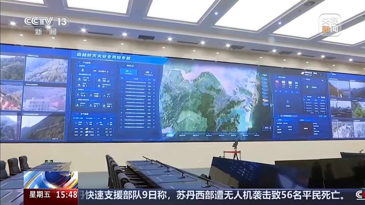
Li Yan, Chief Engineer of the Ningbo Emergency Management Bureau: Our forest fire monitoring hotspots are based on video surveillance of key forest areas along 1688 roads throughout the city, enhanced by AI capabilities. The large model algorithms calculate and, upon detecting fire points or smoke points, automatically trigger alarms.
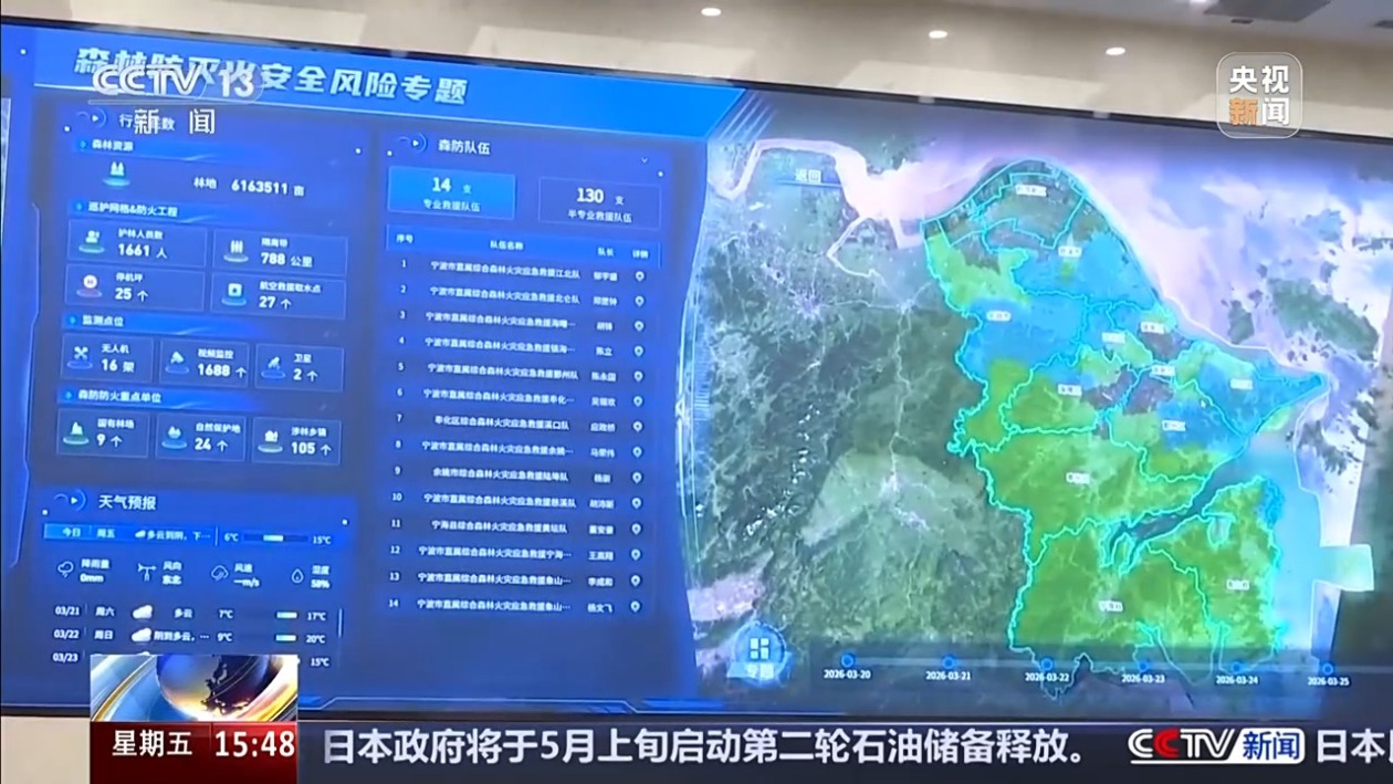
It is reported that Ningbo's "one network" for forest fire prevention and extinguishing has achieved 100% coverage monitoring of key forest areas in the city. It not only visually presents the forest fire risk situation for the next seven days but also allows early warning to be precise down to the township level, greatly improving the accuracy of fire risk forecasts.
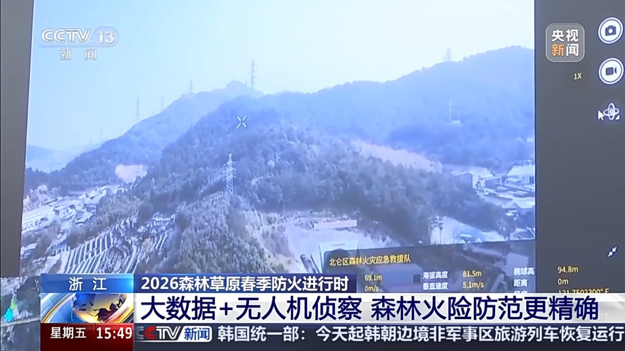
In addition, to more accurately and quickly assess and extinguish forest fire situations, places like Ningbo and Jinhua in Zhejiang are utilizing drone swarms, in conjunction with ground patrol personnel, to establish an integrated aerial and ground forest fire monitoring network, significantly enhancing the efficiency of fire response.
Li Yan: Drones are set to automatically patrol based on the forest fire risk level. For example, if a certain township reaches a high risk, it will automatically patrol, and upon detecting smoke or fire points, it will automatically alert and push notifications to our central platform. Previously, we relied on the public to call in reports; now we actively detect forest fires. The time from discovering a forest fire to extinguishing it used to take at least two hours; now it can be done in as little as half an hour.
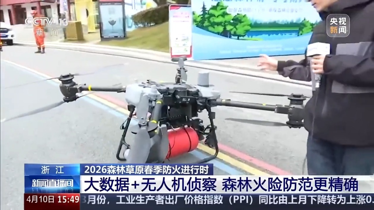
Tang Guorong, Reporter from the Central Broadcasting Station: In addition to using manpower and drones for real-time monitoring of mountain fires, once a fire is detected in the mountains, Ningbo is also equipped with many large fire-fighting drones, which carry a 20kg dry powder fire extinguishing bomb. When detonated, it covers an area of nearly 40 square meters. With such equipment, when a mountain fire is detected and personnel and equipment cannot arrive immediately, it can achieve early suppression of the fire, effectively tackling it early and small.
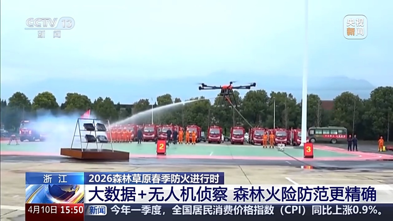
In Jinhua, Zhejiang, reporters saw that a professional drone rescue team, the first of its kind in Zhejiang, has been established, equipped with 11 drones and over 60 rescue vehicles, conducting aerial fire extinguishing and material delivery tasks. Additionally, through social recruitment, more than 20 agricultural plant protection drones and medium-sized logistics drones have been integrated, equipped with specialized fire extinguishing buckets for precise targeting of fire points. By integrating various aerial and ground rescue forces, they can achieve rapid extinguishment of initial fire incidents within 20 minutes.
Intelligent Water Storage + Aerial Rescue Enhances Fire Extinguishing Efficiency
Currently, Jiangxi has entered a critical period for forest fire prevention, continuously enhancing the grid construction of water sources and strengthening aerial forest protection forces for rapid response and handling of fire incidents.

Shangrao is located in the northeastern part of Jiangxi Province, at the junction of Jiangxi, Zhejiang, Fujian, and Anhui provinces. The terrain is mainly hilly, with the Huangshan residual mountains, Huaiyu Mountains, and Wuyi Mountains from north to south, covering a forest area of 20 million acres and a forest coverage rate of 61.16%. It serves as an important ecological barrier in northeastern Jiangxi. The abundant mountain and water resources provide favorable conditions for better water storage and fire extinguishing.

Tang Guorong, Reporter from the Central Broadcasting Station: This is Lingshan in Shangrao, Jiangxi. In response to the local mountainous and rainy terrain and climate characteristics, Shangrao has constructed many large water storage facilities. During heavy rain, rainwater can be effectively collected into these storage facilities, allowing forest firefighters to access water for extinguishing fires immediately when a mountain fire occurs.
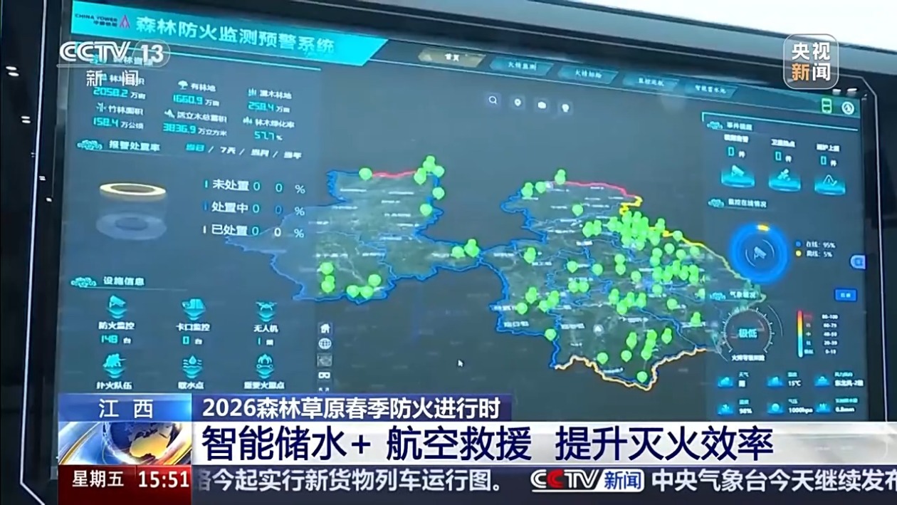
At the local forest fire monitoring platform, reporters saw that over 500 water storage tanks in Shangrao City have been connected to intelligent monitoring functions.
Huang Lvzong, Deputy Director of the Shangrao Emergency Management Bureau: This platform can monitor the real-time water volume, water depth, and capacity of each intelligent water tank. Once the water volume drops below 80%, the system automatically alerts and sends notifications to the relevant maintenance personnel's mobile phones, ensuring timely replenishment of water.

Deputy Director Huang Lvzong introduced to reporters that based on field surveys, most key forest areas within a three-kilometer radius in the city have water sources. Previously, it took at least 30 minutes for firefighting teams to fetch water from the water source and lay hoses for extinguishing fires; this will be improved in the future.

Huang Lvzong: This year, we will complete the construction of 1,500 intelligent water buckets and tanks in key forest areas and scenic spots throughout the city. Once completed, we can reduce the emergency water retrieval service radius from the original three kilometers to two kilometers. In the event of a forest fire, we can basically access water within 10 minutes.
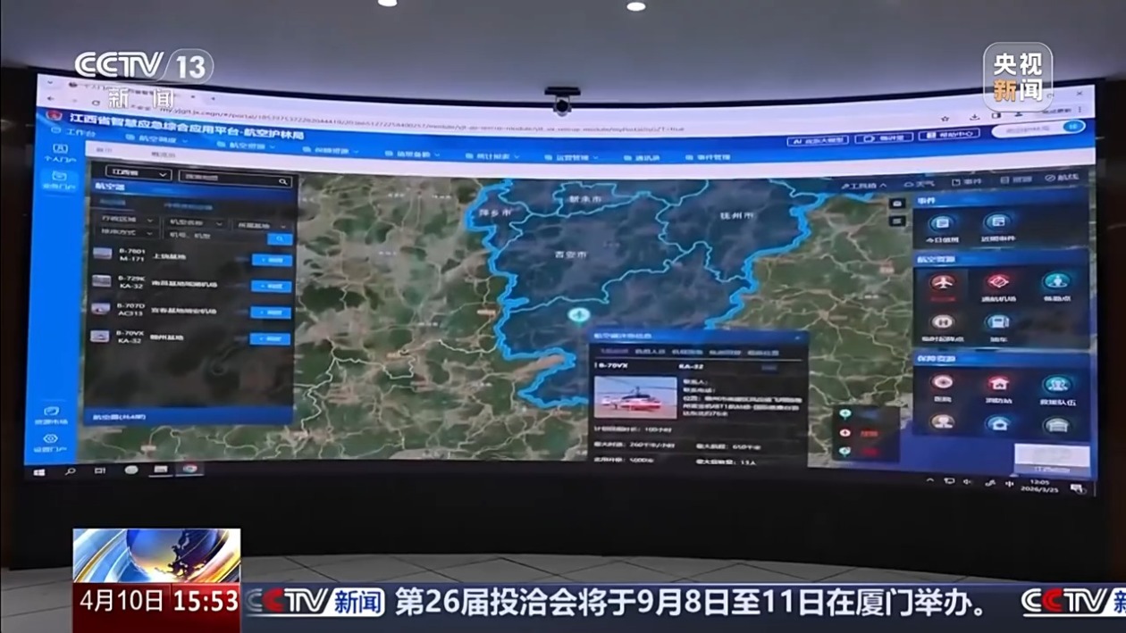
Furthermore, in terms of aerial emergency rescue force construction, the Jiangxi Provincial Aerial Forest Protection Bureau has deployed five high-performance helicopters, taking into account the characteristics of spring forest fire prevention and extinguishing work. These helicopters are stationed at four aerial emergency rescue bases in Nanchang, Ganzhou, Shangrao, and Jing'an, achieving full coverage of aerial rescue forces in key forest fire prevention areas across the province.
Zhu Xiangsong, Director of the Aerial Forest Protection Division of the Jiangxi Provincial Aerial Forest Protection Bureau: By 2026, we will increase the number of aerial emergency rescue routes from 22 to 25 and the number of temporary helicopter takeoff and landing points from over 300 to 500, striving to build a faster response and wider coverage aerial emergency rescue system.
(Reporters from the Central Broadcasting Station: Tang Guorong, Huang Yichen, Ningbo Station, Jinhua Station)
Ningbo's Emergency Management Bureau utilized drones and AI technology for forest fire prevention in Spring 2023. In Jiangxi, large water storage facilities were constructed to support firefighting efforts. Drones autonomously detect fires and alert authorities, significantly improving response times. Aerial firefighting units are now operational across key forest regions in Zhejiang and Jiangxi.
- Ningbo has established a comprehensive monitoring network for forest fire prevention using drones and AI technology.
- Jiangxi has built large water storage facilities to enhance firefighting capabilities.
- Drones can autonomously detect fire points and alert emergency services.
- Aerial firefighting units have been deployed across key forest areas in Zhejiang and Jiangxi.