
Two Donated Old Maps Confirm Japan's Long-Planned Invasion Ambitions: Detailed Markings of Our Coastal Ports, Depth Lines, Ocean Currents, and Shipping Routes! Details of Japan's Invasion of China Exposed →
On September 3, the 81st anniversary of the victory of the Chinese People's Anti-Japanese War and the World Anti-Fascist War, two old maps drawn during the Japanese invasion of China were officially archived at the Memorial Hall of the Victory of the Chinese People's Anti-Japanese War in Zhijiang Dong Autonomous County, Hunan. The exhibition of Qian Dexiang's "Anti-Japanese War Series" oil painting manuscripts was also opened to the public, revealing precious primary historical materials that uncover the historical details of Japan's premeditated invasion of China.
The archived materials were donated by Zhang Qingsong, chairman of the Returned Overseas Chinese Federation of Zhijiang Dong Autonomous County, and include a replica of the "Coastal Provinces of the Qing Dynasty" map drawn by the Japanese Navy Ministry's Waterway Department in 1874, as well as the original "Map of Japan, China, and Korea" published by the Japanese Tongwen Society on the eve of the First Sino-Japanese War in 1894.
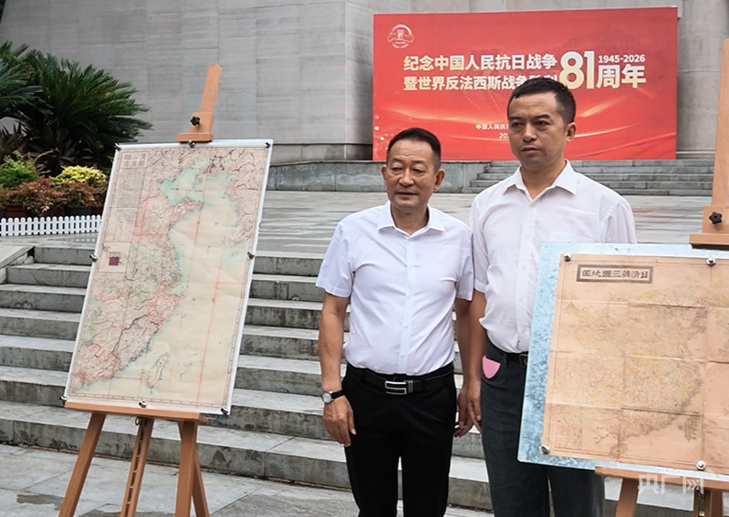
Donation scene (Photo by Wei Mei, provided by China National Radio)
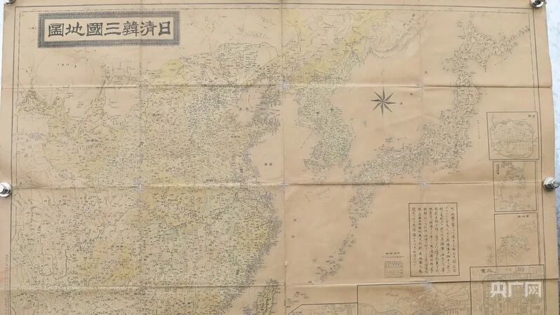
"Map of Japan, China, and Korea" (original) (Photo by Wei Mei, provided by China National Radio)
The museum director, Wu Jianhong, introduced that the "Map of Japan, China, and Korea" was collected from Japan and published on the eve of the First Sino-Japanese War. To prepare for the invasion of China, Japan sent a large number of spies into China that year, operating under the guise of students, merchants, and others to gather intelligence. The map details the depths of coastal ports, ocean currents, and shipping routes in China, accurately calculating the distances between Chinese and Japanese ports to estimate the sailing time of ships and the deployment of troops and weapons. The Korean Peninsula and Northeast China were viewed as a springboard for invading China. This map fully proves that Japan's initiation of the invasion of China was not a spur-of-the-moment decision, but rather a predetermined plan under long-term national policy, with ambitions far beyond the First Sino-Japanese War; the scheme to occupy China and dominate East Asia had already taken shape.
"A large number of intelligence personnel infiltrated our interior, mapping mountains and rivers, hydrology, and meteorology, with dense annotations, which are solid evidence of Japan's meticulous preparations for war before the conflict," Wu Jianhong stated, emphasizing that this history has practical warning significance for maintaining national security today. Currently, Japan's right-wing forces are resurfacing, with some politicians visiting the Yasukuni Shrine and denying the history of the invasion of China and the Nanjing Massacre. The world must remain vigilant against the resurgence of militarism and work together to safeguard the achievements of World War II and the post-war international order.
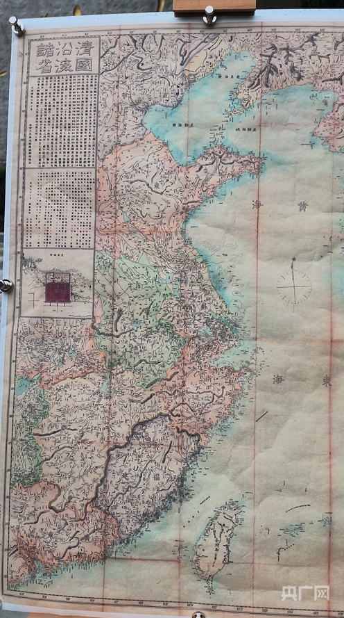
"Coastal Provinces of the Qing Dynasty" map (replica, original still stored in Japan) (Photo by Wei Mei, provided by China National Radio)
The other map, "Coastal Provinces of the Qing Dynasty," was specifically drawn by Japan to plot the occupation of Taiwan. The map outlines important towns and ports along China's coast and plans the routes for a north-south encirclement invasion from Korea and Northeast China, as well as landings along the southeastern coast. Notably, this 1874 map officially drawn by Japan clearly marks Diaoyu Island (Diaoyu Dao), Huangwei Islet, and Chiwei Islet, directly confirming that Diaoyu Island and its affiliated islands have historically belonged to China, serving as strong historical and legal evidence.
The concurrently launched Qian Dexiang "Anti-Japanese War Series" oil painting manuscript exhibition focuses on the Zhijiang surrender, divided into three sections: the surrender on the front line, the surrender in the rear, and the surrender of the Japanese army on the USS Missouri. The exhibits restore the historical facts of the Eighth Route Army and New Fourth Army, following Commander-in-Chief Zhu De's orders, clearing out the Japanese and puppet troops that refused to surrender in places like Gaoyou and Zaozhuang after Japan announced its unconditional surrender in 1945. The Zhijiang surrender marked the beginning of the surrender process in the China theater, and the series of oil painting manuscripts comprehensively showcase the arduous struggle and victory of the Chinese military and people, highlighting the tremendous sacrifices and outstanding contributions of the Chinese People's Anti-Japanese War to the world anti-fascist war.
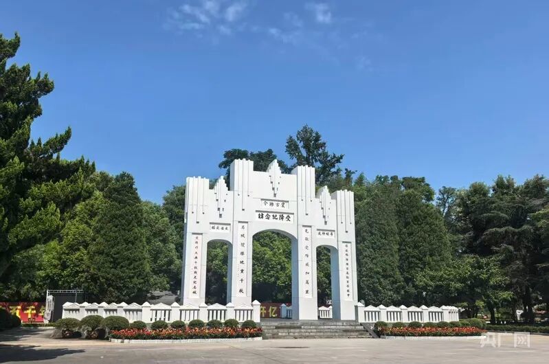
Zhijiang Memorial Hall of the Victory of the Chinese People's Anti-Japanese War (Photo by Huang Kelan, China National Radio)
In recent years, patriotic individuals from home and abroad have continued to donate anti-Japanese war materials to the Zhijiang surrender memorial hall. In April of this year, Australian patriotic student Shen Yifeng donated nine maps of the "Battle of Xiangxi" by the Japanese army; French friends Marcus and Bai Shijie, along with Chinese youth Zhong Haosong, donated declassified materials obtained from the diplomatic archives center in Nantes, France; Zhang Qingsong also donated a batch of materials in July, including a high-precision original of the "Detailed Map of the Russo-Japanese War, Qing, and Korea."
Wu Jianhong stated that the memorial hall will continue to activate these historical materials and artistic resources, regularly carry out commemorative education activities, and use primary historical materials to counter historical nihilism, reminding the public to remember history and learn from it.
Source: China National Radio Hunan Channel
Reporter: Huang Kelan
On September 3, two historical maps illustrating Japan's military ambitions during its invasion of China were donated to the Zhijiang Anti-Japanese War Memorial Museum in Hunan. These maps, created during the late 19th century, detail strategic coastal locations and routes, indicating Japan's premeditated plans for military action against China. The donation underscores the historical context of Japan's military strategies and the importance of remembering this history in contemporary discussions about national security.
- Two historical maps donated to a museum in China reveal Japan's military ambitions during the invasion period.
- The maps detail coastal ports, ocean currents, and navigation routes significant for military planning.
- The donation highlights Japan's long-term strategy for invading China, not a spontaneous decision.