
U.S. Navy hires six firms to map Pacific and Indian Ocean seabeds
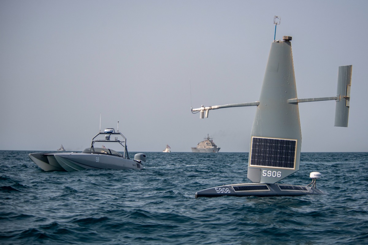 Devil Ray T-38 unmanned surface vessel
The U.S. Navy has selected six companies to send long-endurance unmanned vessels across the Indian and Pacific oceans, where they will build high-resolution maps of the seabed without relying entirely on large, crewed survey ships.
Six companies, AOR International LLC of Melbourne, Florida, Blue Water Autonomy Inc. of Lexington, Massachusetts, Chance Technologies LLC of Lafayette, Louisiana, Link Technologies Inc. of Germantown, Maryland, Ocean Power Technologies Inc. of Monroe Township, New Jersey, and Saildrone Inc. of Alameda, California, were awarded a combined $40,000,000 multiple-award contract to provide high-resolution ocean floor mapping services using long-endurance unmanned surface vehicles for the Naval Oceanographic Office, known as NAVOCEANO, according to a Department of War contract announcement.
NAVOCEANO is the Navy command responsible for delivering detailed knowledge of the world’s oceans to American warfighters, producing the charts, depth surveys, and seafloor data that submarines, ships, and amphibious forces depend on to navigate safely and operate effectively in unfamiliar or poorly mapped waters.
The contracts are structured as indefinite-delivery, indefinite-quantity agreements, a government procurement format that establishes pricing and terms upfront without guaranteeing a specific amount of work, meaning the Navy will only pay for actual services once it issues individual task orders against the contract rather than committing the full $40,000,000 immediately. All six companies will compete against each other for those individual task orders throughout a two-year base ordering period with no option to extend, running from an anticipated start in August 2026 through July 2028. The Navy structured the deal this way specifically because it could not reasonably predict in advance how work would ultimately break down among the six contractors or which company would win any particular mapping assignment, since that competition happens fresh each time a task order comes up.
Every mission performed under this contract will take place in international waters of the Indian Ocean and Pacific Basins, well beyond U.S. territorial boundaries, based entirely on NAVOCEANO’s operational needs at the time. That geographic focus places the work squarely within a region where the Navy has increasingly prioritized detailed seafloor knowledge, since accurate bathymetric data, the technical term for precise measurements of underwater depth and terrain, directly supports anti-submarine warfare by helping crews understand where a hostile submarine might hide along seafloor ridges or canyons, while also informing safe navigation routes for the Navy’s own submarine fleet operating in contested or poorly charted waters.
The unmanned surface vehicles likely to perform this work represent a considerable leap over traditional ocean mapping methods, which have historically required a crewed research vessel and a trained onboard team working for weeks or months at a time. Saildrone, one of the six awarded contractors, has already built vehicles specifically for this kind of mission, including its 20-meter (65.6 ft) Surveyor-class vehicle, a wind and solar-powered platform capable of sailing for up to 100 days at sea while carrying Kongsberg multibeam sonar systems that map the seafloor down to depths of 11,000 meters (36,089 ft) to standards set by the International Hydrographic Organization. Vehicles like this replace the need for a large crewed ship and its associated fuel, staffing, and logistical costs, letting the Navy collect detailed seafloor data across vast, remote stretches of ocean at a fraction of the traditional expense and without putting sailors at sea for extended, isolated deployments.
The contract emerged from a competitive process that drew nine offers submitted through the System for Award Management website, the federal government’s official contracting portal, and the solicitation was specifically structured as a small business set-aside, a designation that limits eligible bidders to companies meeting federal small business size standards rather than opening the competition to larger, established defense contractors. That structure gave smaller, more specialized ocean technology companies a genuine path to compete for Navy work that might otherwise have gone to a handful of traditional prime contractors with far larger existing government relationships.
Fiscal Year 2026 Navy operations and maintenance funds covering each contract’s minimum guarantee amount of $10,000, totaling $60,000 across all six awards, were obligated at the time of the contract signing and will expire at the end of the current fiscal year, a standard practice ensuring each awarded company receives at least some guaranteed minimum payment even before any specific task order gets issued. Additional funding for the actual mapping missions themselves will come from whatever fiscal year’s operations and maintenance budget is active when the Navy issues each individual task order, with that funding’s expiration timeline depending entirely on when those specific orders get placed. Naval Supply Systems Command Fleet Logistics Center Norfolk, based in Norfolk, Virginia, is managing the contract on the Navy’s behalf.
Content preview only. Full article available at source. View Full Article
The U.S. Navy awarded contracts to six companies to deploy unmanned surface vessels for high-resolution seabed mapping in the Indian and Pacific Oceans from August 2026 to July 2028. This initiative aims to enhance anti-submarine warfare capabilities by providing detailed oceanographic data. The total contract value is $40 million, with operations occurring in international waters.
- U.S. Navy awarded contracts to six companies for seabed mapping.
- Total contract value is $40,000,000.
- Contracts will run from August 2026 to July 2028.
- Mapping will occur in international waters of the Indian and Pacific Oceans.
- The unmanned vessels will enhance anti-submarine warfare capabilities.