
GNSS Jamming in the Strait of Hormuz Affects 1,100 Ships and Exposes the Fragility of Gulf Maritime Defense 2026
 Ahmed Al-Rashid
GNSS Jamming in the Strait of Hormuz Affects 1,100 Ships and Exposes the Fragility of Gulf Maritime Defense 2026
On May 25, 2026, the most dangerous signal coming from the Strait of Hormuz was not a new Iranian missile or a boat laying a mine, but a navigation screen showing a 200,000-ton cargo ship as if it were moving over an airport runway. This is not a technical joke. A report by Le Monde indicated that around 1,100 ships were affected on the first day of the war alone by navigation signal interference, and that the Strait of Hormuz and the Arabian Gulf have become, alongside the Red Sea, the Black Sea, and the Baltic, centers of maritime jamming in the world. From a military perspective, this information is more important than the number of missiles fired in a single week, as it reveals that the Gulf battle has moved to a layer that ordinary citizens cannot see and does not appear in images of explosions.
The War That Does Not Require Hitting the Ship
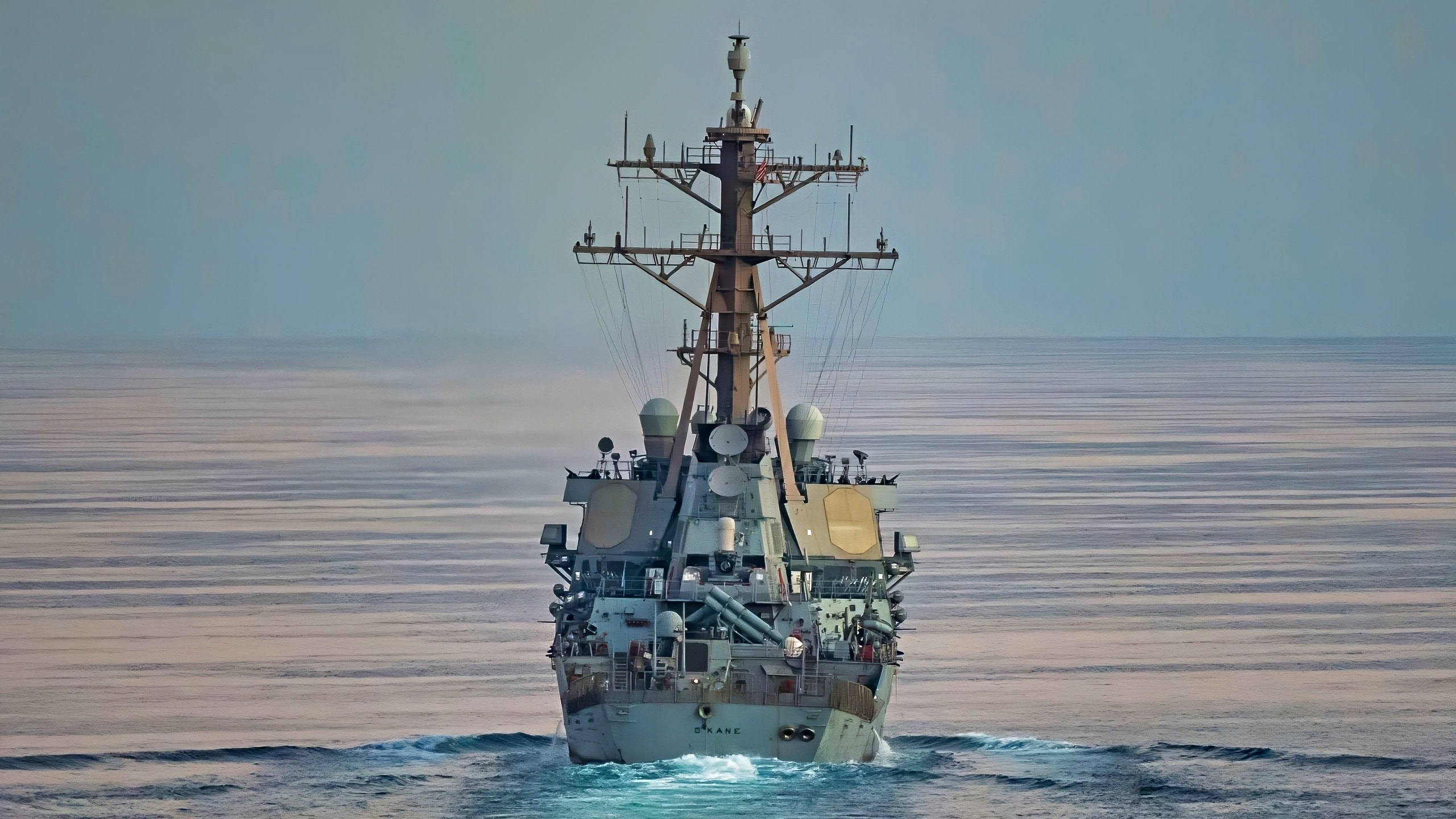
Since February 28, as the war between the United States, Israel, and Iran has escalated, Hormuz has become not just a narrow maritime passage but an open laboratory for electronic warfare. Jamming GNSS, whether it affects GPS or other navigation systems, does not sink the ship or burn the port, but it makes the ship blind in a crowded and narrow passage. The officer sees an incorrect location, speed becomes questionable, and the AIS system may display a false identity or location. At sea, a small mistake does not remain small.
The incident involving the tankers Front Eagle and Adalynn near Khor Fakkan in June 2025, on a day that witnessed heavy jamming activity, should be read today as an early warning rather than a separate maritime accident. The modern commercial ship is larger and less tolerant of error, and the crew accustomed to electronic navigation does not easily revert to paper maps and compasses. Any military personnel who has served in the region knows that the distance between Bandar Abbas and Fujairah is not long, but the distance between the decision to jam and the occurrence of a collision can be mere minutes.
Iran Does Not Always Need to Close the Strait
The traditional Gulf debate asks: Can Iran close the Strait of Hormuz? This question has become incomplete. The smarter capability is not complete closure, but raising the cost of passage until insurance becomes more expensive, captains more cautious, and markets more tense. A complete closure of the strait would provoke a direct and extensive American response. However, intermittent jamming, misleading AIS data, and moving ship locations on the screen hundreds of kilometers away are tools that fall into the gray area between war and incident.
A report by Associated Press on May 25 stated that the U.S. Central Command conducted defensive strikes in southern Iran against missile launch sites and boats laying mines, despite Washington's talk of negotiations going well. This timing is significant. Above the surface, there are negotiations in Qatar and messages of de-escalation, while below the surface, there are strikes against launch platforms and mine-laying boats, and in the signal layer, there is jamming preventing trade from operating with confidence. This is not a complete ceasefire, but rather a management of violence at varying degrees.
The Gulf Gap Is Not Just in Buying Ships
Gulf countries have spent over two decades on frigates, patrol boats, reconnaissance aircraft, and coastal radars. However, Hormuz today is testing something deeper: Do these countries have a maritime institution capable of operating when the digital picture is unreliable? Owning a coastal radar is not enough if there are no clear procedures to integrate its data with visual monitoring, patrol aircraft, shipping company information, and American, French, and British operations centers. Here, the triangle of capability that I always return to appears: equipment, training, and institution. The Gulf has purchased a lot of equipment, but it still pays the price for weak institutional integration.
Practically, jamming places the Gulf navy in a difficult position: protecting trade that is not entirely state-owned. The tanker may be owned by a Greek company, flying a Panamanian flag, insured by a British company, and transporting Emirati or Qatari oil to Asia. Who will decide that an AIS error is an attack? And who will order military intervention if the ship itself does not know that its identity has been digitally stolen? These are operational questions, not just legal ones.
The American Umbrella Does Not See Everything
The paradox is that the United States has the strongest naval presence in the region, yet it is unable to eliminate the small commercial risks that accumulate in the corridors. Axios noted that the path of U.S.-Iranian understanding includes a gradual opening of Hormuz and subsequent negotiations that may last 30 to 60 days. This means that the strait itself has become a negotiating item, not just maritime geography. When the passage becomes a bargaining chip, every ship passing through it becomes part of political pressure, even if no one fires at it.
The Gulf states understand this well, which is why Riyadh, Abu Dhabi, Doha, Cairo, Ankara, and Pakistan have pushed for the deal instead of resuming war. But at the same time, they know that stopping missiles does not necessarily stop jamming. Iran can lower the level of visible violence while maintaining electronic and maritime pressure. This is a relatively cheap way to demonstrate capability, especially if the adversary is spending millions of dollars on each missile interception while a jamming device or coastal network is enough to confuse dozens of ships.
A Lesson from Patriot and THAAD to the Sea
In the air, the Gulf has learned that Patriot and THAAD do not solve the problem alone. Defense News mentioned in April that the $4.7 billion PAC-3 contract comes amid a heated debate about the cost of intercepting cheap drones with expensive missiles, with a difference that could reach 114 to 1 in favor of Iran if PAC-3 is used against a cheap threat. The sea repeats the same lesson, but in a less dramatic way: not every navigational error should be treated as if it were a missile, nor should it be ignored as if it were a civilian malfunction.
The practical solution is not to buy a single new platform with a foreign logo. What is needed is a multi-layered verification network: coastal stations capable of detecting jamming, maritime patrol aircraft operating over Hormuz and the Gulf of Oman, rapid response teams to escort sensitive ships, and real training for civilian and military captains on navigation when GNSS is lost. The UAE possesses part of this capability, and Saudi Arabia, Qatar, and Oman have other parts, but the danger does not respect national borders. Jamming that begins near Bandar Abbas can show its effects on the screen of a ship near Fujairah or Duqm.
What This Crisis Means for Regional Power
If the measure of power is the number of fighters and missiles, then the Gulf appears strong. If the measure is the ability to keep ports and corridors operating under continuous electronic and maritime pressure, the picture is less comfortable. Israel sent Iron Dome to the UAE, according to Janes, which proves that air defense networks are changing rapidly. However, naval defense cannot be borrowed in the same way. A country cannot import expertise in controlling a sensitive strait in a week, as it imports an interception battery or an operating crew.
What Hormuz reveals in May 2026 is not just a technical weakness, but a continuous political dependency. The Gulf wants freedom of decision, but it needs the U.S. Navy to manage escalation, European companies to analyze risks, and Western systems to read the sky and sea. The old military adage says that the map is not the territory. And in Hormuz today, the screen is not the sea. Those who cannot fight when the screen lies will continue to buy the latest systems while fearing the oldest problem in war: losing direction.
Sources
- Le Monde, May 25, 2026, on navigation signal jamming in Hormuz
- Associated Press, May 25, 2026, on U.S. defensive strikes in southern Iran
- Axios, May 23, 2026, on the framework of U.S.-Iranian understanding and the gradual opening of Hormuz
- Defense News, April 10, 2026, on the cost of PAC-3 and accelerating interception production
- Janes, May 13, 2026, on the deployment of the Israeli Iron Dome in the UAE
On May 25, 2026, Iranian military jamming of GNSS systems affected approximately 1100 ships in the Strait of Hormuz, revealing vulnerabilities in maritime defense. This electronic warfare tactic complicates navigation and raises operational risks for vessels in the region. Concurrently, U.S. forces conducted defensive strikes against Iranian missile launch sites, indicating ongoing military tensions.
- Approximately 1100 ships affected by GNSS jamming on the first day of conflict.
- The Strait of Hormuz has become a center for maritime jamming.
- Iran is using intermittent jamming to raise the cost of maritime navigation.
- U.S. Central Command conducted defensive strikes in southern Iran.
- The situation reflects a shift in the nature of conflict in the region.