
U.S. Navy tests camera navigation for drones over jammed seas
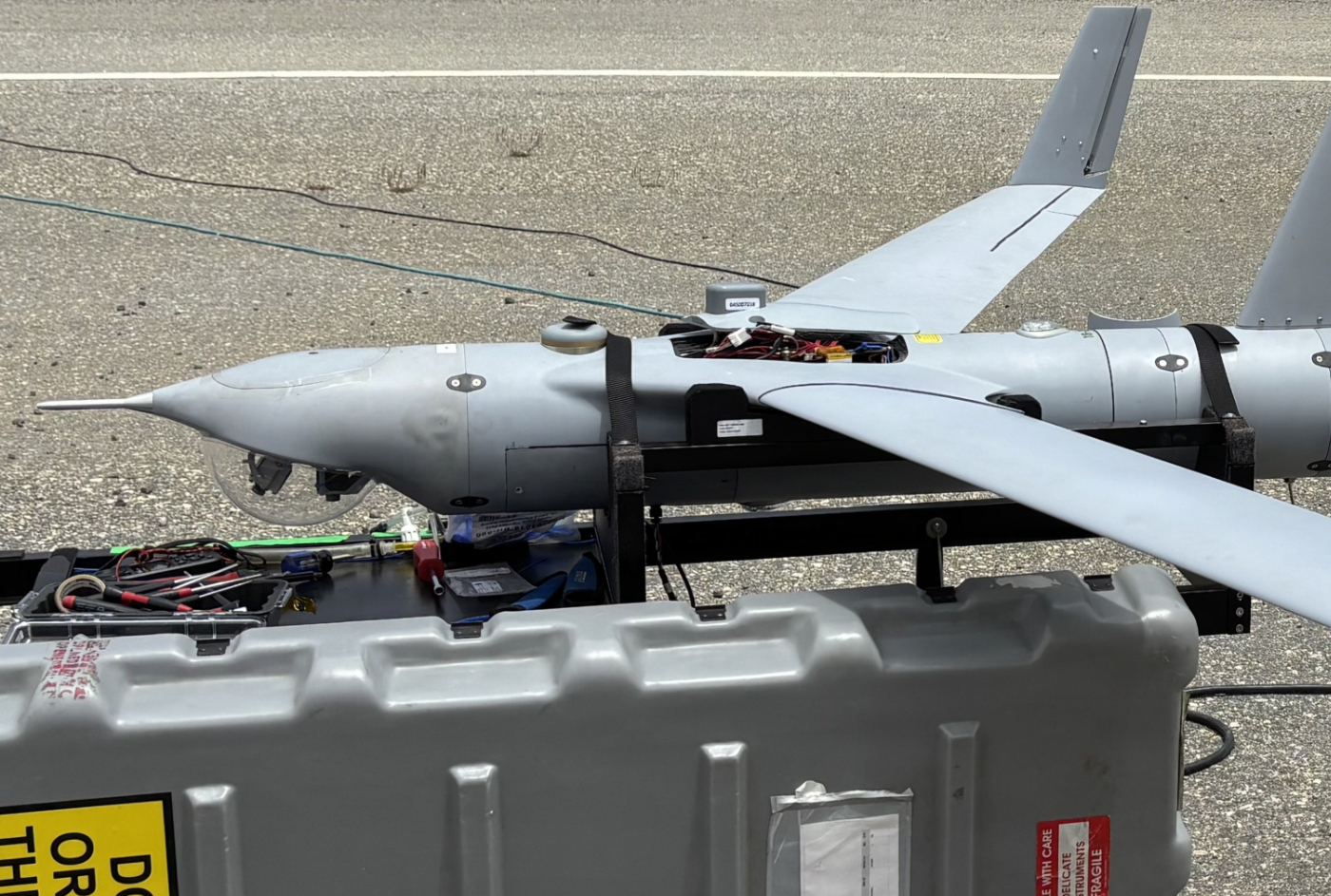
A ScanEagle drone flew for six hours over open ocean off Southern California without GPS and stayed on course using cameras and motion sensors, the Naval Postgraduate School said in an account of the tests published this week.
The navigation system comes from Rhoman Aerospace, a small California company, working with researchers at the U.S. Navy’s graduate school in Monterey. The drone hit its waypoints “several miles away from land” near San Clemente Island with satellite navigation and ground links switched off in a simulated loss, according to the school.
“In the GPS-denied environment, our navigation system allowed the ScanEagle to perform closed-loop flights with under 0.5 percent drift versus distance,” said Tom Youmans, Rhoman’s chief executive.
That figure works out to less than 500 meters of position error for every 100 km (62 miles) flown. Closed-loop means the drone was steering by the system’s own position estimates during the flight. They weren’t just recorded for comparison afterward.
The school didn’t say when the flights took place or how far the drone flew in total. It gave no detail on sea state or weather, and it didn’t explain how the system gets a usable picture from moving water.
If the numbers hold up across rougher seas and longer legs, a drone could cross a stretch of jammed ocean and arrive close enough to its target area for its own sensors to finish the job. Jamming and spoofing of satellite navigation are routine in Ukraine and the Middle East, and long flights over water are the norm in the Pacific.
Camera-based navigation already works over land. A drone’s cameras pick out features on the ground, its software matches them to a map or tracks how they move from frame to frame, and accelerometers and gyroscopes fill in the motion between frames. The technique is called visual inertial odometry. AeroVironment has sold a kit of this type for its Puma drones since 2022.
Water breaks the method. Waves move, look alike, and leave nothing permanent to map. “The surface of water has no permanence to map,” the school’s account said, “and sensor-fusion algorithms need to be adjusted for such an environment.”
Youmans described the approach only in general terms. “Our VIO system works by fusing camera data with sensor data and drone flight telemetry to let the drone estimate its position without GPS,” he said. “We’re doing a few different methods of sensor fusion to enhance the solutions for maritime environments. And it can work with or without preloaded terrain maps.”
Rhoman’s hardware is small: cameras, a compact computer and software carried as a payload in the ScanEagle’s nose. The second half of the system is the school’s own autonomy software, which takes Rhoman’s position estimates and flies the aircraft. Normally a drone reports its position to a ground station, and the station sends commands back. Lose GPS and a human has to fly it by eye. Lose the radio link too and nobody can.
The school’s software sits on the aircraft and takes over when both are gone. “Think of it as another ground station, but on the UAV,” said Aurelio Monarrez, the project’s principal investigator and a faculty researcher at the school. “If you give it a mission to fly it to some island, it’s going to fly there regardless of whether you have GPS, a payload link, or a C2 link.”
The team worked up to the ocean flights in stages. Rhoman first flew its payload at the school’s quarterly field experiments at Camp Roberts, California, where the company has tested since 2019. Separate inland flights on the ScanEagle followed. Then the team went to San Clemente Island, where two Naval Special Warfare operators launched and recovered the drone inside U.S. Navy restricted airspace.
Money for the work came from several places. The school and Rhoman signed a cooperative research agreement, and funding came from a school-run robotics consortium and from the U.S. Air Force’s AFWERX small business technology transfer program. Federal contract records show the Air Force Research Laboratory gave Rhoman a first-phase award of about $110,000 in December 2023 for GPS-denied navigation on the ScanEagle, and a second-phase award worth up to $1.8 million in February 2026 that covers both land and maritime use. Those records describe the company’s earlier work as funded by U.S. Special Operations Command.
The U.S. Navy is testing other approaches too. In October, the Naval Air Warfare Center Aircraft Division said a tactical drone had flown mission tasks and landed on a pitching vessel at sea without GPS, using cameras and motion sensors.
Rhoman’s system isn’t tied to the ScanEagle, a 1990s design that needs a catapult to launch and a cable to recover. The next step is to move it to AeroVironment’s JUMP 20, which takes off and lands vertically and flies for more than 13 hours with a range of 185 km (115 miles). The U.S. Army picked the JUMP 20 in 2022 to start replacing its RQ-7B Shadow.
Future flights will “expand the flight envelope and incorporate the effects of additional atmospheric and surface conditions,” the school said.
Content preview only. Full article available at source. View Full Article
The U.S. Navy tested a ScanEagle drone off Southern California, successfully navigating without GPS for six hours using a camera-based system developed by Rhoman Aerospace. The drone maintained its course with minimal position error, demonstrating potential for operations in GPS-denied environments. Future developments aim to enhance the system for maritime conditions and integrate it with other drone models.
- A ScanEagle drone flew for six hours without GPS using cameras and motion sensors.
- The navigation system was developed by Rhoman Aerospace in collaboration with the U.S. Navy.
- The drone achieved waypoints several miles from land with less than 500 meters of position error for every 100 km flown.
- The system allows the drone to operate autonomously without GPS or radio links.
- Funding for the project came from multiple sources, including the U.S. Air Force.